A Monitoring Program to Determine the Effect of Global Change on Alpine Plant Communities in the San Juan Mountains, SW Colorado
The Third Site in of the Global Observation Research Initiative in Alpine Environments (GLORIA) Program in North America
What is GLORIA and Why in the San Juan Mountains?
GLORIA is a long-term, global observation network for the comparative study of climate change impacts on mountain biodiversity, specifically plants. There are 42 GLORIA target regions worldwide, and nine are located in North America. GLORIA uses a multi-summit approach and standardized low-impact monitoring methodology, allowing the study of alpine plant communities and climate change impacts both within and among regions.

Ecosystems of the alpine life zone are considered to be particularly sensitive to global warming because they are adapted to low temperature conditions. Alpine communities are also limited in their migration ability to reach higher altitudes or latitudes due to the island nature of mountain tops. Alpine environments contain a relatively high number of endemic species (i.e., species that occur only locally) that risk extinction. A site in the San Juan Mountains is extremely useful in understanding alpine flora biodiversity, community patterns, and impacts of climate change, increasing air pollution, and spread of exotic plant species at a mid-latitude continental mountain range. In some areas of the San Juan Mountains, such as Silverton, temperatures have risen over one degree Celsius in the summer and four degrees Celsius in the winter since about 1970. It is crucial to understand how these increasing temperatures affect alpine tundra and treeline vegetation in this region.
What are the Benefits of the San Juan Mountain GLORIA Program?
Establishment of a long-term observation system that can detect early warning signs of climate change and other stresses such as air pollution and exotic species invasions.
Data on alpine plant communities that will aid in understanding changes to alpine biodiversity and spatial patterns in the San Juan Mountains and will allow comparison to mountain ranges throughout the world.
Stewardship of alpine ecosystems.
Education of undergraduate and graduate students.
What progress has been made?
Monitoring plots were installed and surveyed from July 29 to August 9, 2006 on four mountain summits on BLM public land near Lake City, Colorado. The summit elevations range from 12,195 to 13,800 ft. Temperature dataloggers were dowloaded in summer 2008 and 2009. The plots are scheduled for monitoring every 5 years. The second monitoring phase was completed in 2011. MSI is partnering with Colorado Bureau of Land Management (BLM) to continue the program and the team completed monitoring in 2021.
An analysis of 2006 baseline data was completed by Dr. Julie Crawford for her dissertation with the University of Pavia, Italy. MSI will build upon her analysis by adding in the 2011, 2021 and 2026 data sets.

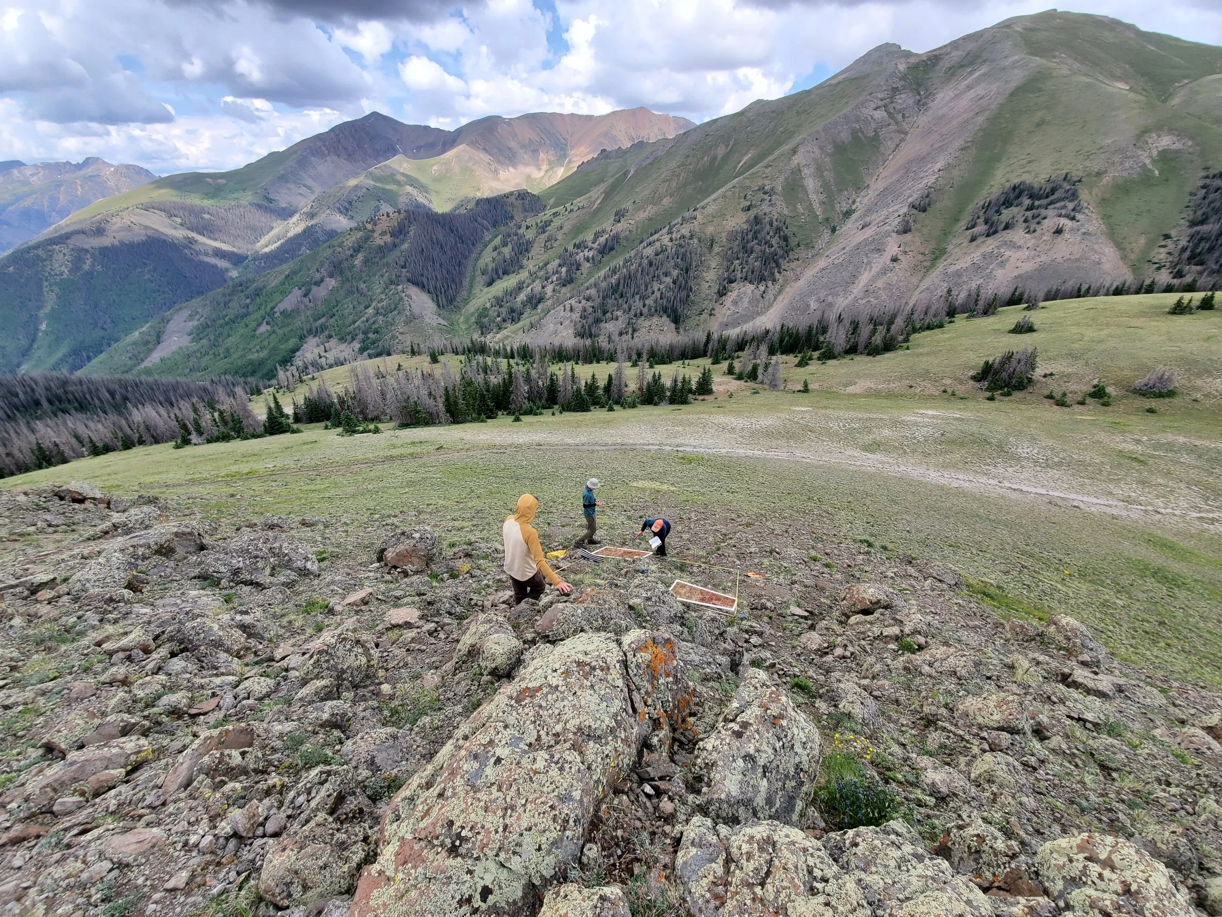
MSI began planning the project more than a year prior to field work and several candidate locations were considered before picking the Lake City area. The project requires four summits along an elevation gradient beginning from just above treeline. The mountain tops have to be as conically-shaped as possible so that plots can be located on all four sides. Furthermore, geology and climate have to be very similar and peaks have to be as accessible as possible while avoiding areas impacted by recreation or mining.
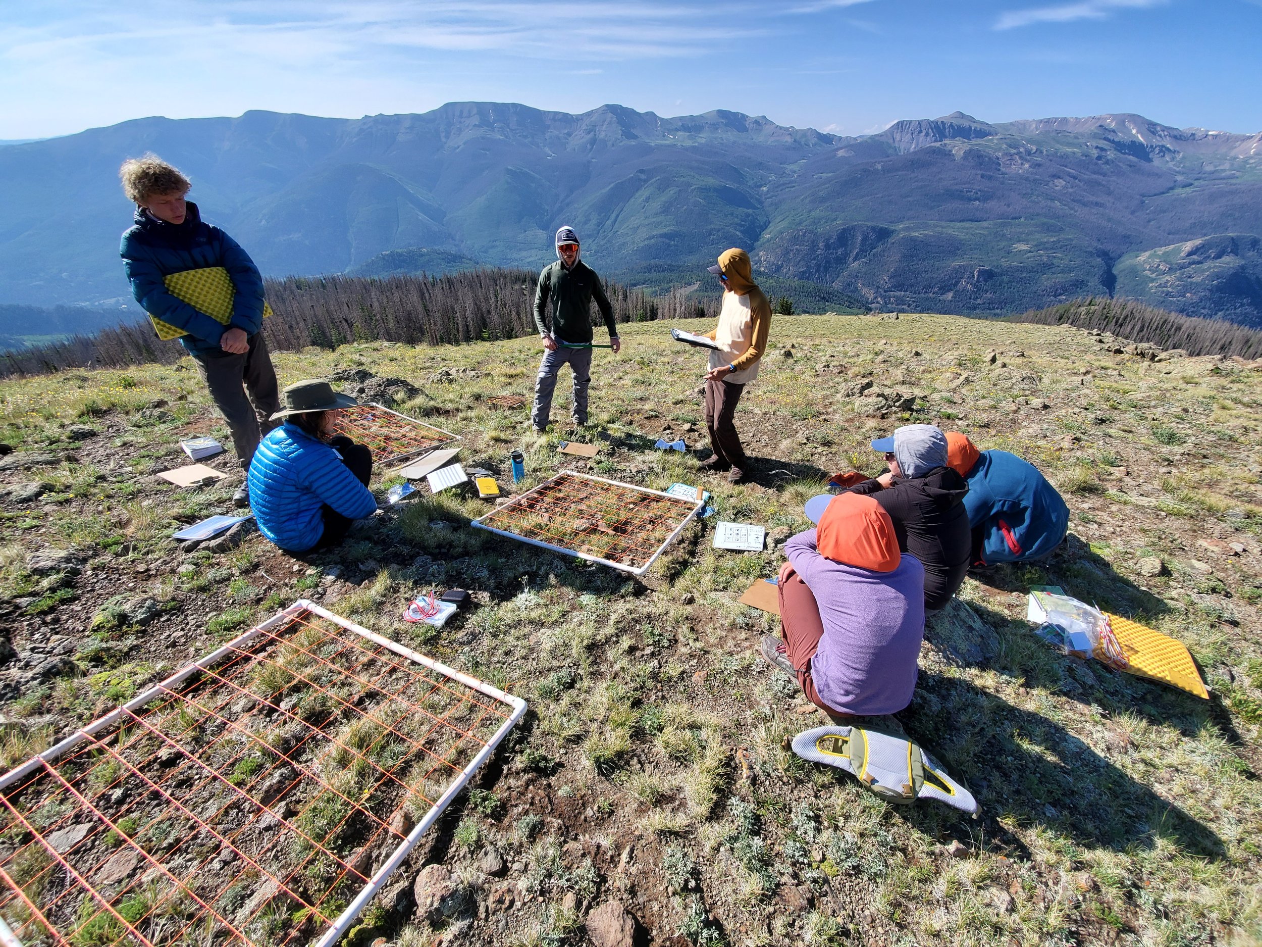
The physical impacts associated with GLORIA projects are very minimal, by design. Each of the four summits is monitored using a specific observation protocol extending no farther than 10m below and 100m horizontal distance from a summit, with four main plots located at a specific distance below the summit in the primary cardinal directions. There are a total of 16 x 1 m2 temporary gridded quadrats (i.e., four in each plot). To facilitate repeat studies, small monument stakes (easily removed) or paint markers are installed to mark the summit origin point and the plot corners. The protocol also includes installation of a tiny, self-contained soil temperature monitoring sensor at a shallow depth inside each plot. The multi-summit array is observed at least once every five years with each summit requiring a team 2-3 full days to complete. Temperature sensors are downloaded every 2-3 years.
2026 marks twenty years of monitoring at the San Juan GLORIA site. This year we will also be adding a CrustNet site to sample biological soil crusts (biocrusts) in the high alpine. Our team of staff and volunteers completed monitoring and maintenance in late July 2026 and will continue analysis through early fall.
Principle Investigators:
Colin Tucker PhD, Anthony Culpepper, Julia Ledford, MSI
Thanks to our collaborators who helped initiate the project:
Dr. Koren Nydick, who initiated the program during her tenure at MSI, currently with Rocky Mountain National Park
Peggy Lyons and Dr. Julie Crawford – Botanists, Colorado Natural Heritage Program and University of Pavia, Italy
MSI 2011 staff & interns: Chris Peltz, Kyle Skaggs, Lindsey Lennek, Beth Adams, Michael Freer, and Michael Costello
2006 Volunteers: Ellen Stein, Dr. Michael Kelrick & his “Wilderness Conservation Biology” class from Truman State University.
Thanks to the project funders and supporters:
2026 Survey, Analysis and Maintenance:
Zia Taqueria
Alpine Bank
Sisters on Leadership Expeditions (SOLES)
2021 Resurvey, Analysis and Maintenance:
Colorado Bureau of Land Management (BLM)
2011 Funds for Survey:
Tres Rios Field Office of the BLM
2008-2009 funds for ongoing maintenance:
San Juan Public Lands: USFS & BLM
2006 Funds for project initiation and baseline survey:
San Juan Public Lands: USFS & BLM
Mountain Studies Institute
The Nature Conservancy of Colorado
American Alpine Club
Colorado Native Plant Society
Colorado Mountain Club