416 Fire Monitoring
MONITORING UPDATES & MEMOS
Explore the new 416 Fire story map documenting post-fire forest and aquatic monitoring by MSI researchers and our partners. Be sure to revisit this living document that can/will be updated with new photos and results from 2020!
Water Quality Monitoring
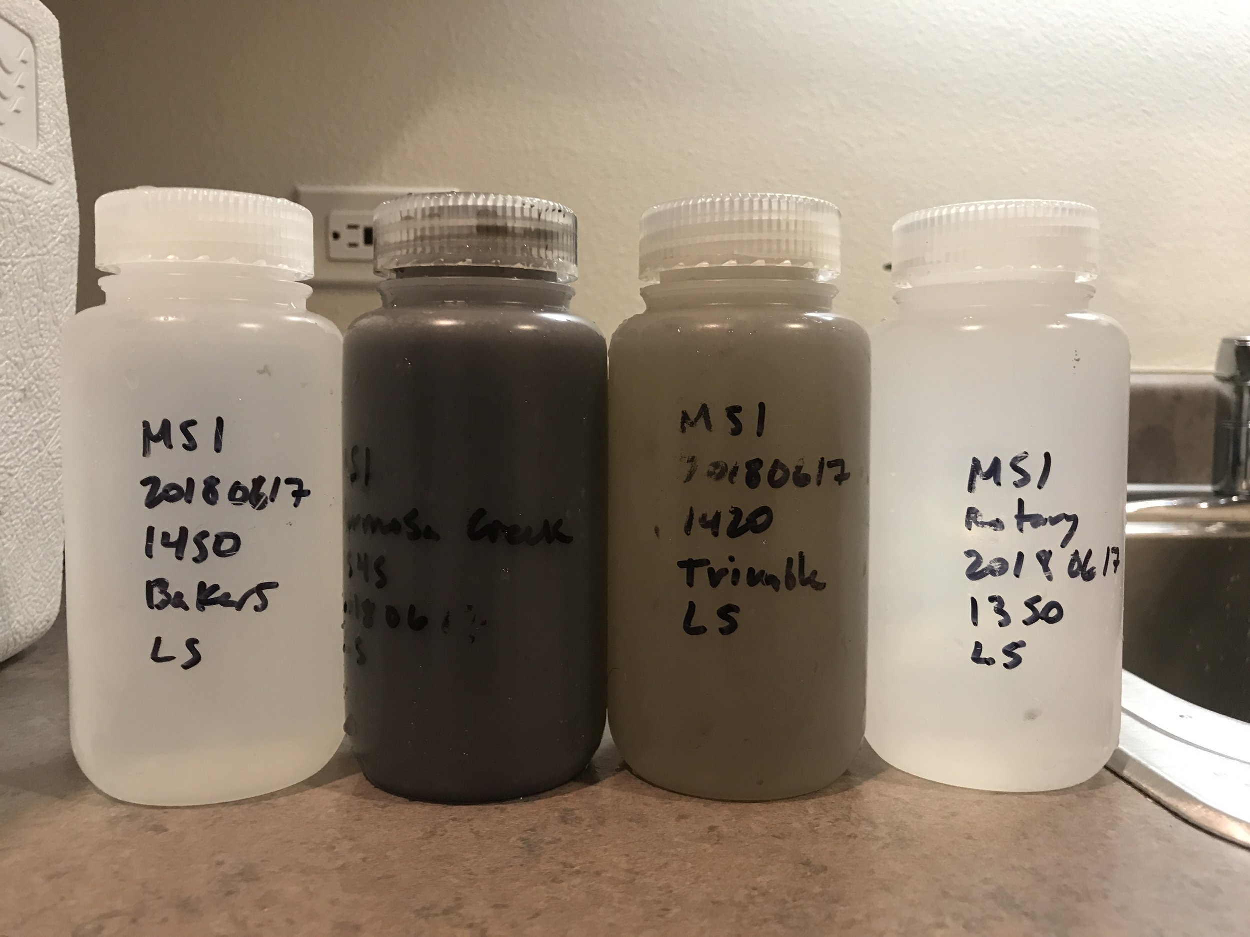
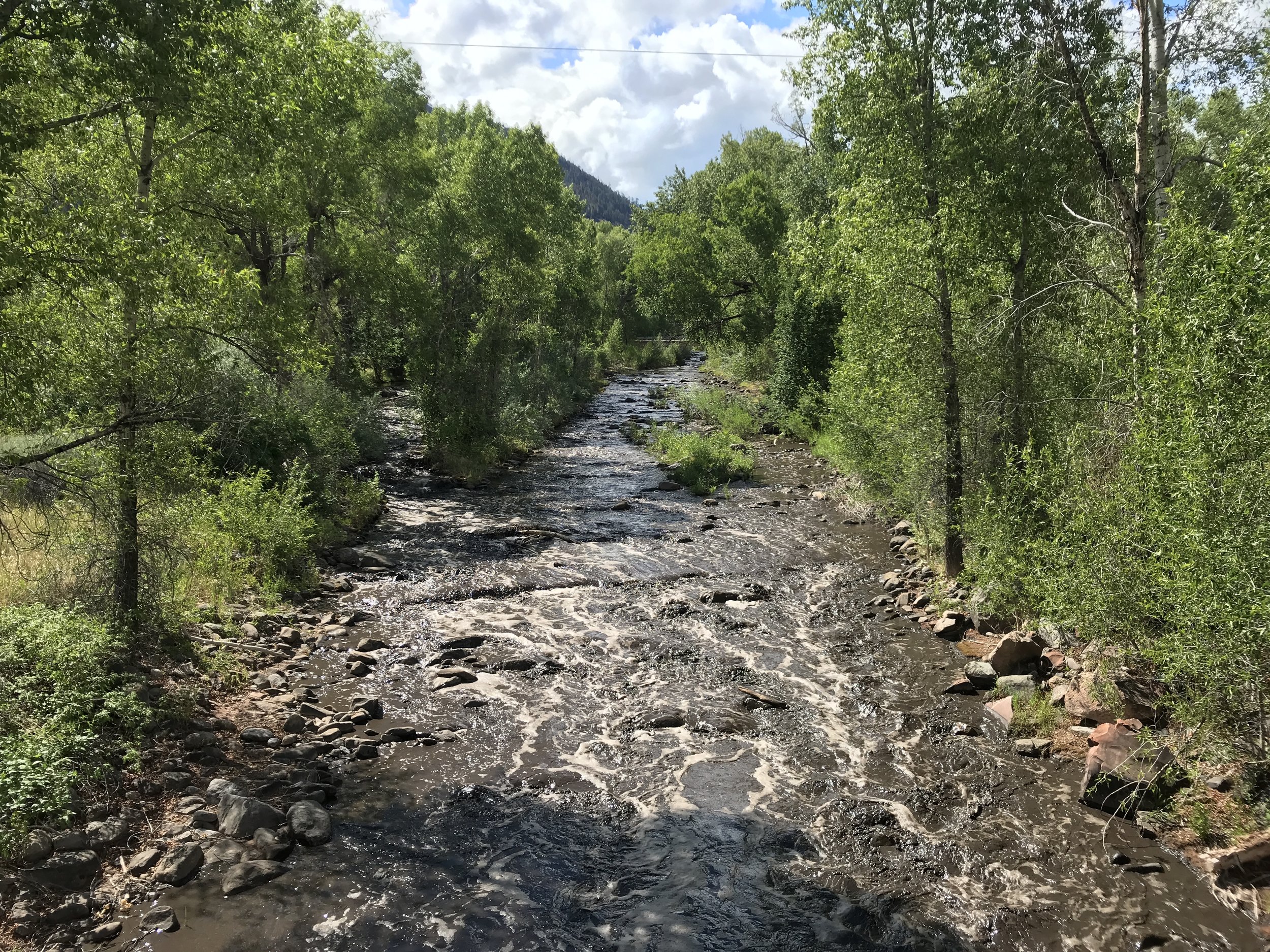
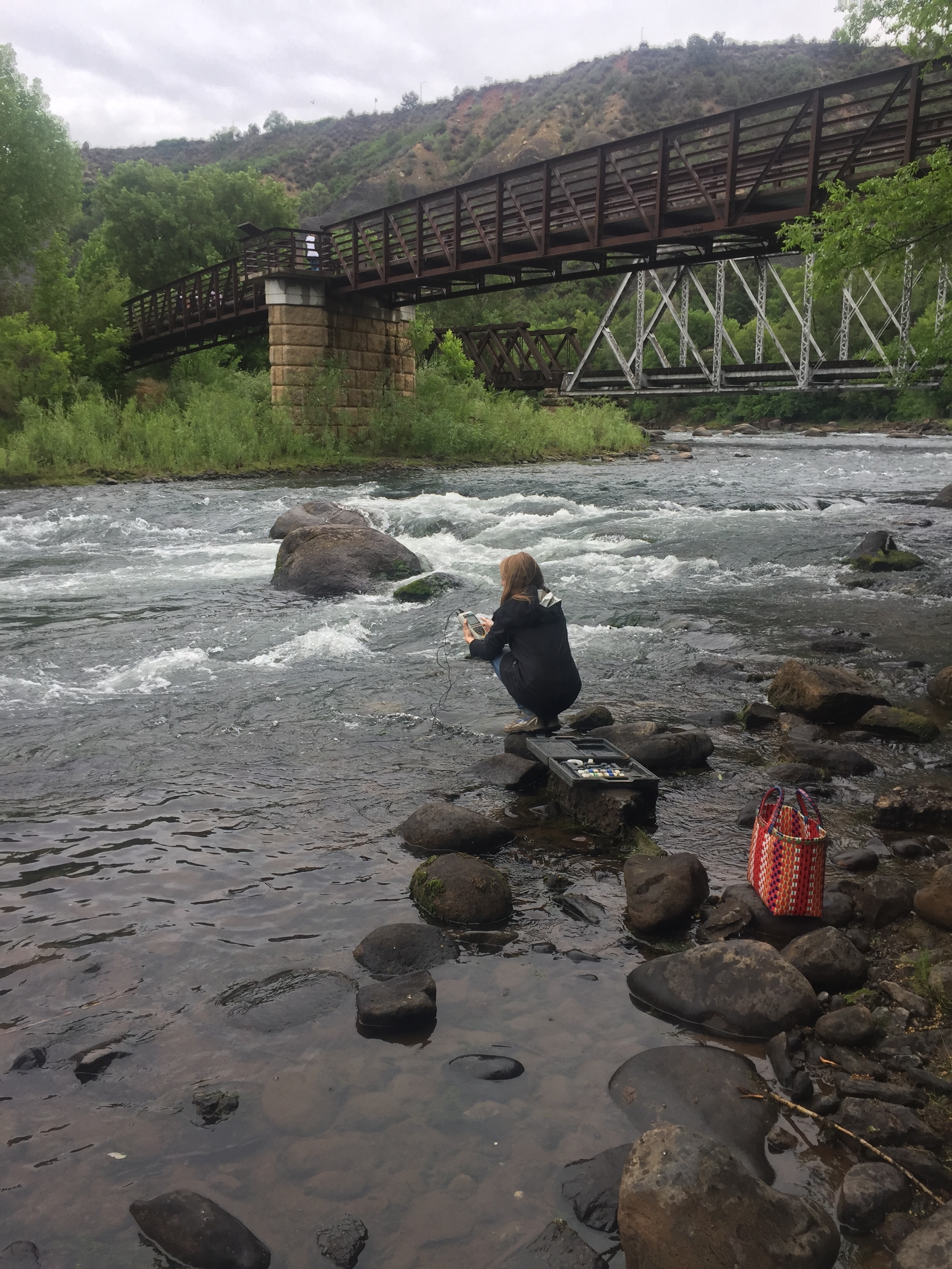
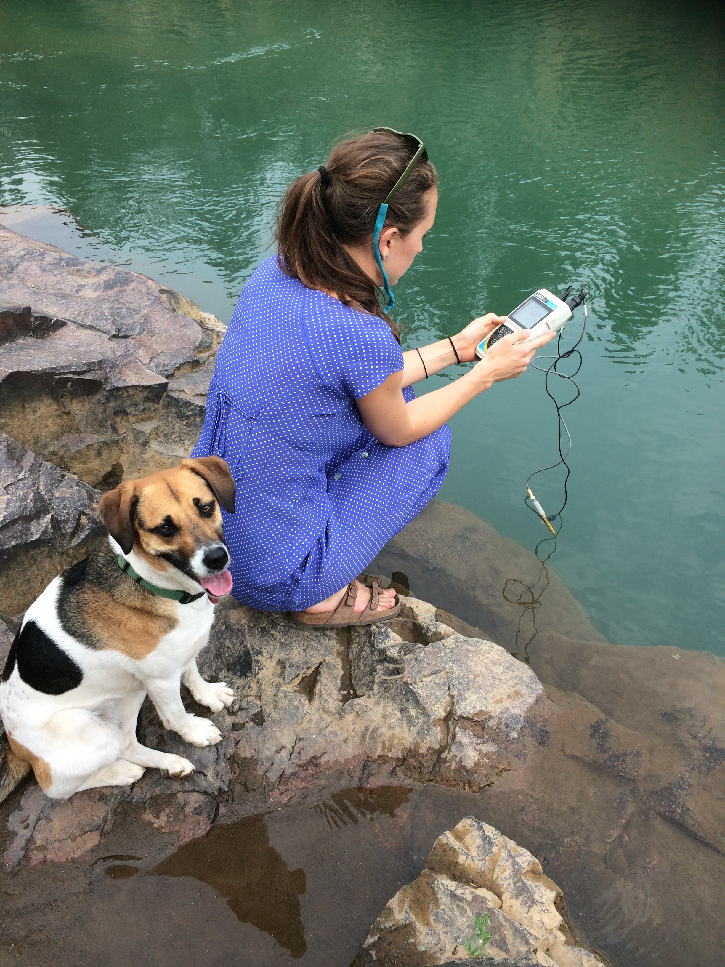
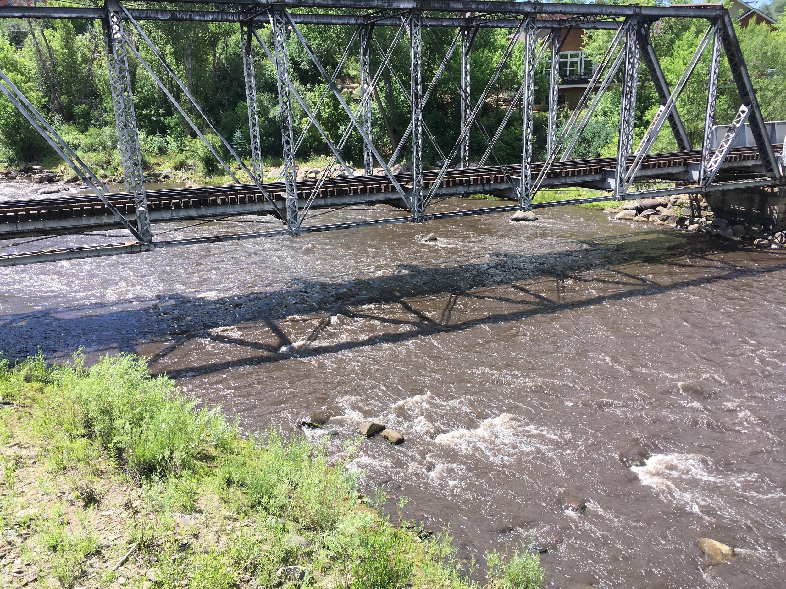
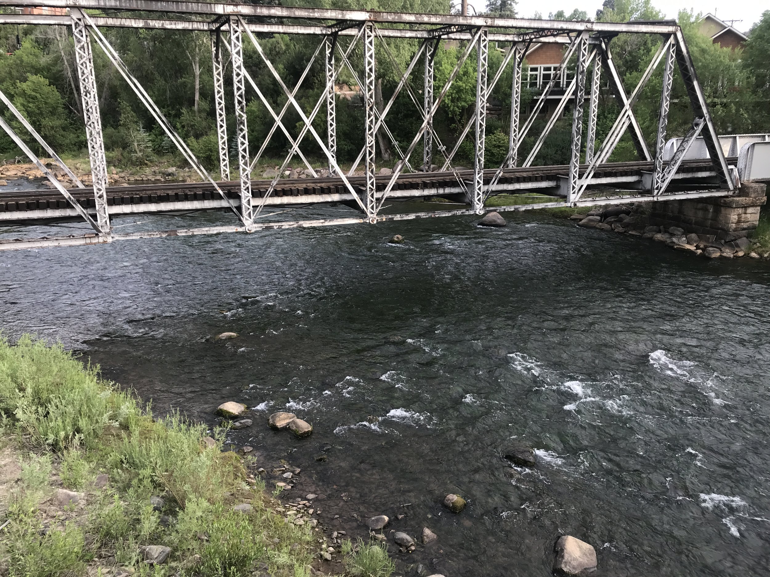
When the weather forecast showed rains for the weekend of June 16th, our team at MSI mobilized to monitor the impacts to Hermosa Creek and the Animas River watershed. In order to establish a baseline for comparison, we started our sampling on Friday, before the rains arrived, and continued through Monday, after Hermosa had begun to clear again. The samples taken are currently being analyzed for metals, nutrients, and measures of sediment, and results will be shared soon.
Moving forward, we hope to work with partners at the San Juan National Forest, San Juan Basin Health, Colorado Parks and Wildlife and others to develop a long term plan for monitoring our watershed.
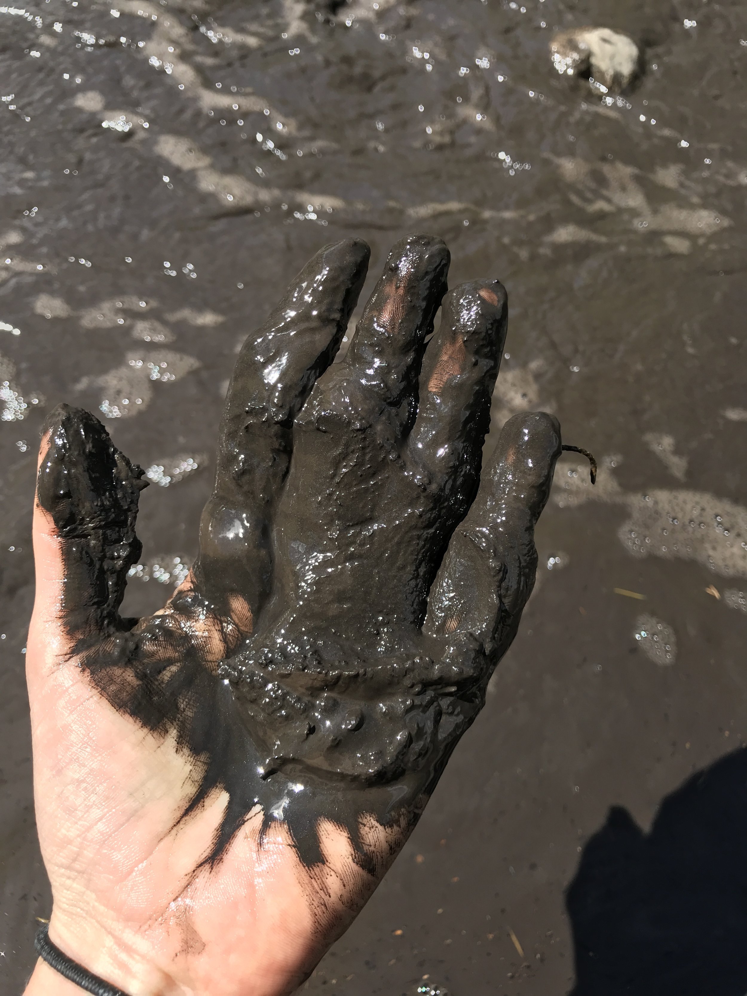
Extreme heat from wildfire can change the nature of the soil, causing a hydrophobic, or water resistant layer. It acts much like a rain jacket on the slope, causing water to run downhill and carry loose sediment, ash, and debris with it. If the hydrophobic layer is deep in the soil, everything above the layer is more likely to slough away in the rain. With little soil to absorb water or vegetation to stop it, floods and debris flows are a common sight after fire. These effects often last for years, as seen during the Missionary Ridge Fire.
Runoff from fires scars can increase pH, water temperatures and nutrient loads, and decrease dissolved oxygen, which all pose potential threats to aquatic life. The sediment itself can cover sensitive macroinvertebrates (river bugs) and clog fish gills, forcing them to search for habitat downstream or perish.
We hope our samples will offer a snapshot into the potential impacts of runoff on the Animas River and Hermosa Creek, and allow us to compare those results to other burned areas across the country.
Research Areas of Interest
This map displays prescribed burn areas completed in 2008 in the Hermosa creek watershed. Also displayed is the soil burn severity layer courtesy of the 416 Fire BAER team.
Other Forest Monitoring
First and foremost, we aim to support the community in its immediate efforts to address the 416 and Burro Fires. Looking forward, we will discuss possible roles for MSI to aid in research on the impacts and recovery from the fire. We look forward to seeing the initial Burned Area Emergency Report (BAER), and developing a plan with partners for filling in gaps and building off that report.
Potential Research Questions:
How did areas previously treated with prescribed fire differ from other areas?
What will be the impacts from debris flows and mudslides? Where will they occur?
How will the fire influence sediment-loading to Hermosa Creek and other Animas River Tributaries?
How has the fire impacted champion trees?
How will the fire/post-fire impact local fisheries?
How has the fire impacted the Hermosa Creek Special Management Area & the adjacent Hermosa Creek Wilderness?
How much of the forest did this 'kill' with high intensity vs 'rejuvenate' at 'historically expected intensity' with which the forest adapted?
How will drought continue to impact the region?
What kind of long-term vegetation changes can residents expect to see on the forest and public lands?
How did this fire compare to historic fires in similar forest types?